!.jpg)
SAHARA
Text and photos by Vlad Wojcik, 2000
A hostile but exceedingly beautiful realm roughly the size of Canada. It was once situated at the North Pole. In its Tibesti mountains (Chad) you can see the remnants of the time when Sahara was covered by glaciers. The vast oil deposits found in the desert point to the time of dinosaurs, when the Sahara was mostly a swamp. During early human civilization the Sahara was a fertile grassland. Ancient Egypt could not have developed as it did if it were not for this fact. Lake Chad, now full of mud, was once a freshwater inland sea with many rivers flowing into it. It would empty its waters into the Atlantic, into the Bay of Benin.
Nowadays the desert is expanding, and with global warming, overgrazing, the Sahel (arid region south of the Sahara) is shrinking. Lake Chad is drying out as the desert creeps south.
There is still a lot of water in the Sahara, but mainly underground. The countries of the Sahara are trying to tap into these aquifers, trying to make the desert bloom, but the examples of desert irrigation in the West point to the dangers of aquifer depletion and salinization of the land.
This page is intended to give you an idea and hints of travel through this land. The photographs that follow originate from the environs of Figuig (south-eastern Morocco, on the Algerian border).
Today, only one sixth of the Sahara is covered with sand. The rest is rocky, or covered with gravel. You have to have a properly equipped 4WD vehicle to travel there. Only basic equipment is described here. If you plan to travel over the sand seas (ergs) more specialized equipment is needed.
Diesel engine, although less powerful than gasoline engine, is preferred. Diesel fuel is easier to find, more economical, and affords higher mileage. On the highways you need power, hence gasoline engines, to travel fast. In hard terrain you travel slowly - you need torque. Diesel offers higher torque. Diesel offers better mileage, too. A custom made, high-capacity fuel tank is highly recommended. This is important: many people having missed their destination by a little bit, started looking for it, driving back and forth, until they ran out of fuel... Some of them died. They drank their water first, then the radiator fluid...
The death from dehydration is a terrible agony. Rationing of water only prolongs the agony. Human body, trying to keep itself cool, loses water at a steady rate of approx. 2 gallons per day through perspiration. This when in shade and at rest.
What to do when the car breaks down? Hopefully you have a radio transmitter. Use it to call for help. You will have to tell your rescuers where to find you. To know that use the GPS. Make sure your car is easy to see. Be prepared for a long wait for the rescue - one week at least! Stay in shade. Where is the shade? Under your car. Do not walk anywhere! When walking, human body loses approx. 4 gallons of water per day. You will be dead, but your carcass will be no more than 20 miles from your car.
There are good roads in the Sahara, too. For example:
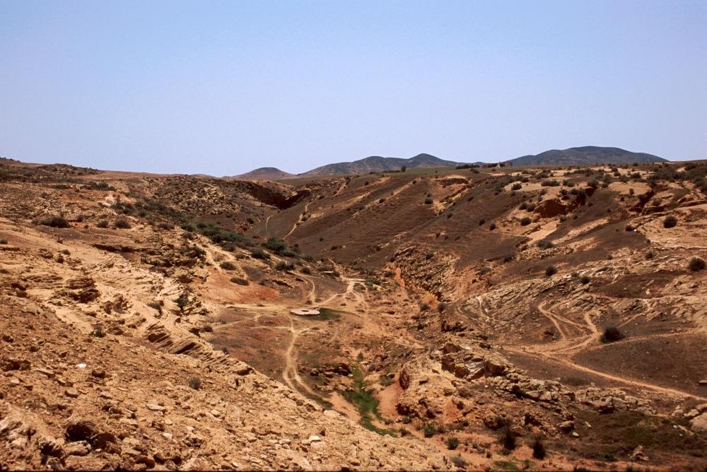
This is a fancy road, wouldn't you say? Completely of European or North American standard. However, such roads are rare. Most "roads", called pistes, look less impressive. If you would try to run just across the desert, using your GPS, then the terrain might look like this:
Can you see a piste in this photo?
This is still a civilized place.
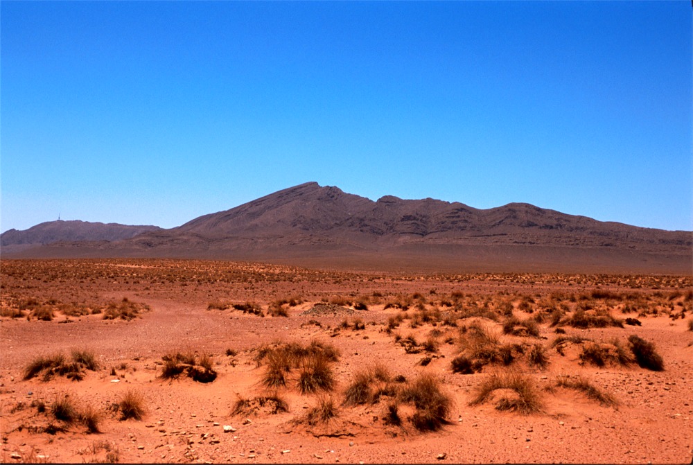
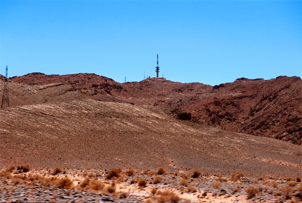
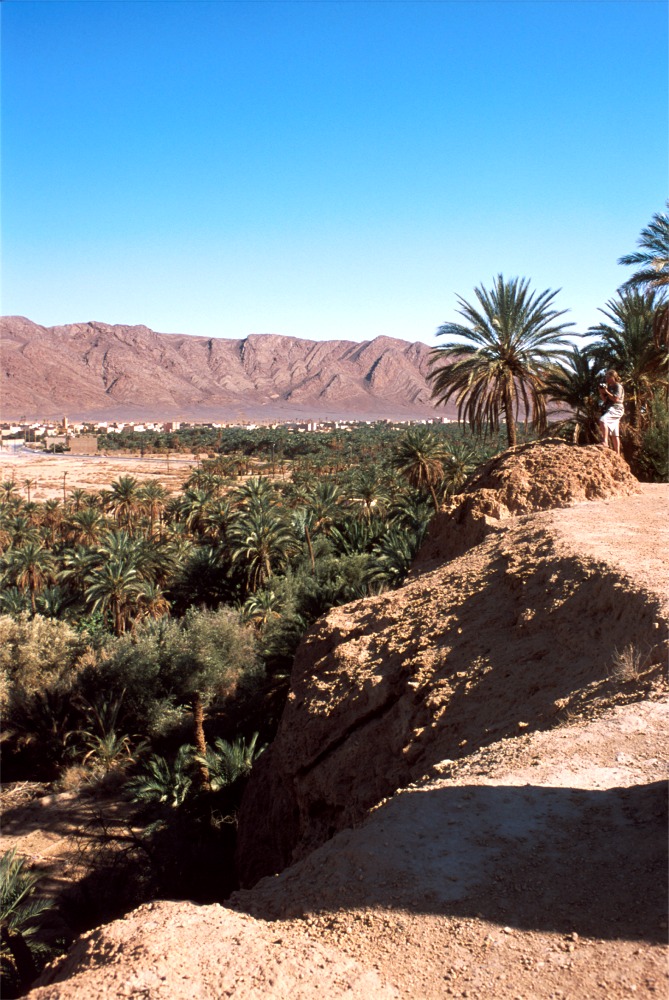
Do you see a communications tower on the mountain afar? There are people, there is
water. Close up, that place looks like this:
Not all places are so hospitable. You cannot always follow the road. The roads, if any, sometimes avoid borders. The borders between countries vary: some are friendly, some unfriendly, some unfriendly and mined. There are mines and smuggling between Morocco and Algeria, Morocco and Mauritania, in Western Sahara. There are mines between Libya and Chad. There are old minefields dating from W.W.II between Libya and Egypt. There is banditry and Tuareg insurrections in Algeria, Niger, Chad. One has to be careful and plan the trip accordingly.
You may find rock paintings depicting hippos, giraffes, elephants dating from times when Sahara was green. Djanet, Tadart are such places.
There are rivers in the Sahara - now most of them dry. In the west they are called "oueds", "wadis" in the east. After a rare rain, they may carry water. Sometimes, too much water! The riverbeds look more or less like this:
(Actually, this picture was made on the border of the Sahara - a lot of lush green vegetation is here. Somebody dug a well at the bottom of this oued. Oueds are good places to dig for water, provided it is close underground. Digging for water in the right place might save your life, but remember - when digging for water in the Sahara, your body loses approx. 6 gallons of water per day. To put this figure in perspective: you reach a point of no return with loss of approx. 3 gallons of water. You cannot survive then without medical attention even if given water - you will not be able to swallow).
This terrain gives you some idea of a desert travel. Here is more detail:
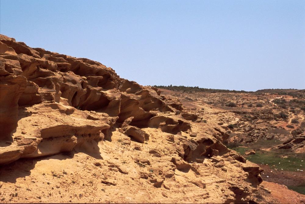
Note characteristic weathering of this sandstone rock - due to sun and wind, rather than rain. The "rock" crumbles under your foot. Twisting of an ankle may be a serious affair if you are alone and not close to your car...
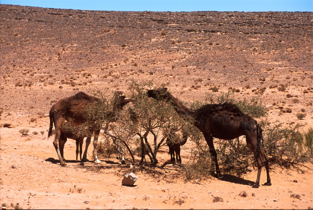
Coming back to the Sahara proper: you may meet wildlife. Here is a sample of a family of wild camels, chewing a stunted acacia tree:
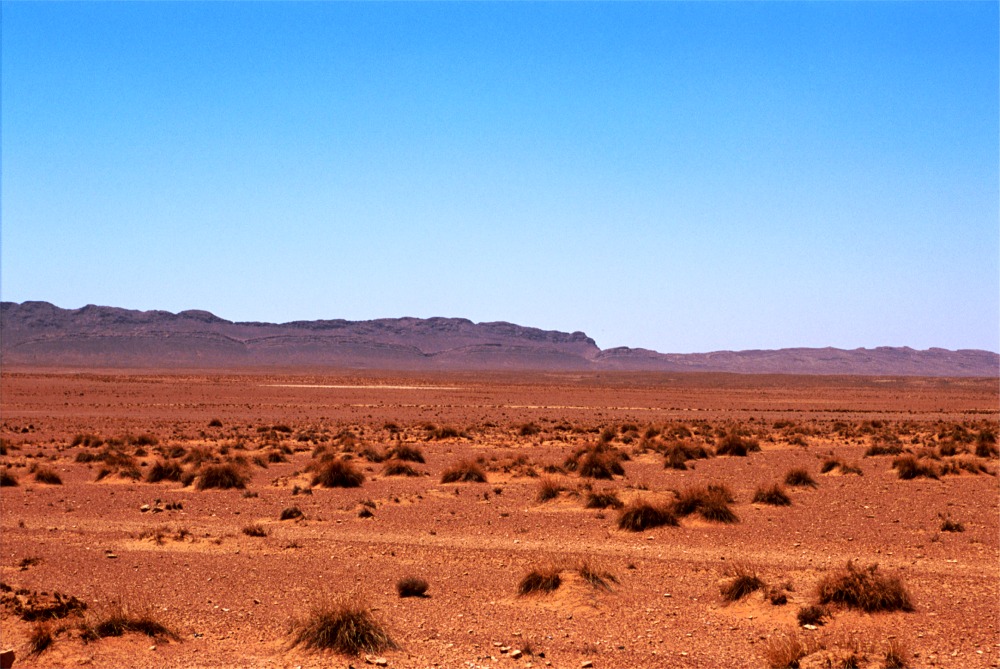
Suppose you travel for hours or days in a terrain like this:
Would it not be a relief to see an
oasis?
(Definition: an oasis is a place with enough water to allow people to grow date
palms).
The Figuig oasis:
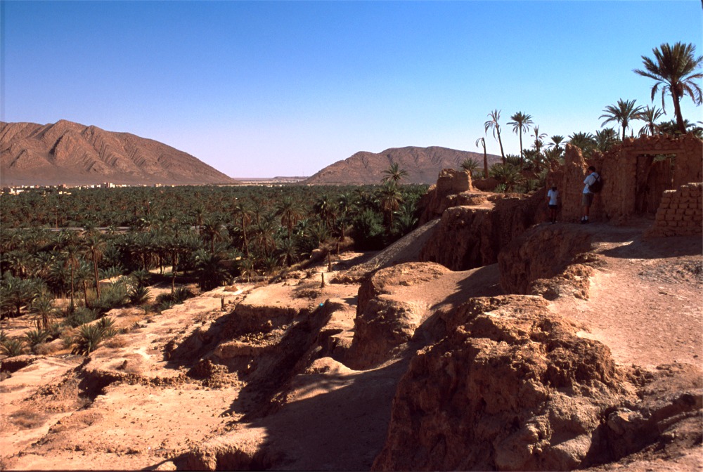
This valley has enough groundwater to sustain date palm trees. 20,000 of them, in fact. Afar, between the mountains, is a settlement called Beni Ounif, in Algeria. There is a road from Figuig to Beni Ounif. The road is closed, with the military watching through binoculars. The relations between Morocco and Algeria are strained. it is a long story. A quick conclusion: nobody can pass. There is no legal overland connection between Algeria and Morocco. Smuggling is done by trained donkeys who cross the border without human company.
At night you can see the lights of Beni Ounif, and car lights. No cars can come from there to Figuig, though.
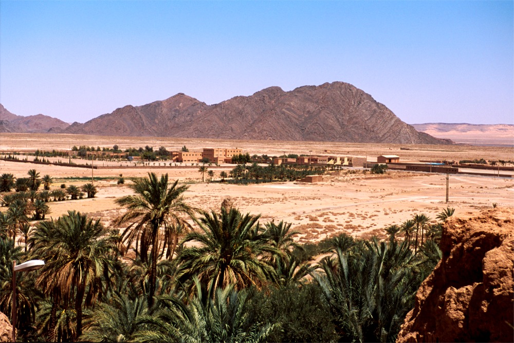
Another panorama of the desert, on the outskirts of Figuig. The low hills behind the mountains are in Algeria.
You may ask: How do people live there? What you see below, are actually gardens.
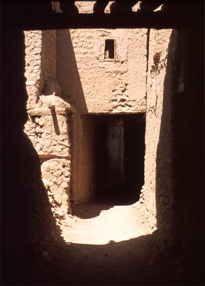
The only local building materials there are mud and palm wood. People live traditionally in lightly fortified villages called "ksars". The photo below shows the walls of one of the ksars in Figuig. Its walls are made of sun-baked mud bricks, kept together by mud.
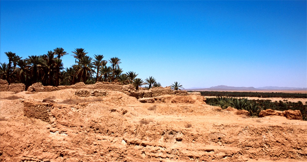
Here is another look, with better detail:
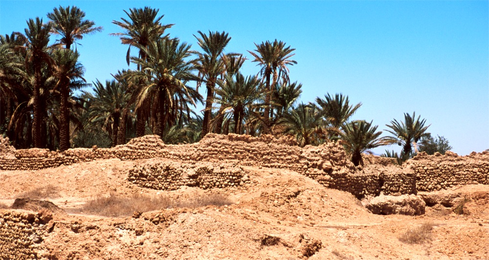
The walls are crumbling. Mud is not the best building material. Actually, life in a ksar is that of perpetual renewal: you cannot stay in given mud quarters for more than five years. The mud will crumble. While living in one place you must build the next place; then you move. A ksar so rebuilt several times becomes uninhabitable: too much work is needed to keep rebuilding it. It is easier to move elsewhere and build another ksar. The old ksar, with water, is a valuable resource too: it becomes a garden.
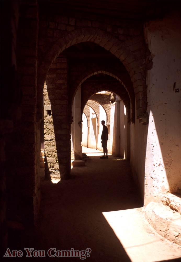
Below is a shot made in a passage of an abandoned ksar:
Following are some shots of the garden:
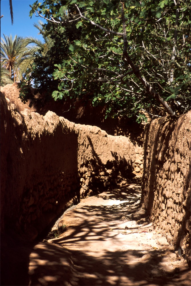
Above: a passage partly shaded by fig
trees (hence the name Figuig).
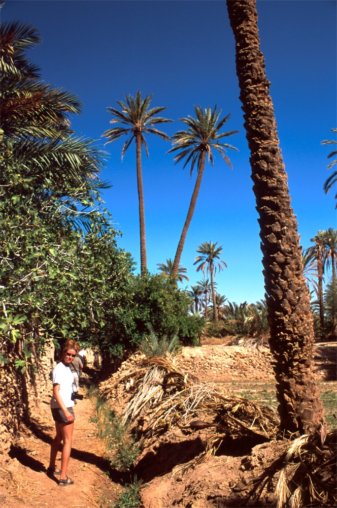
Above: my daughter, Amina (an Arabic
name), in a Saharan garden.
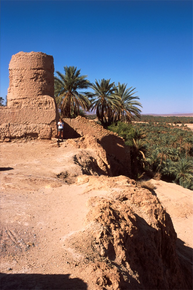
Amina, standing at the base of the French watchtower, is taking a picture of her dad.
The French had their fortifications here. Not all regions of Africa were treated the same by the French. Algeria was intended to become a province of France. Islamic culture was discouraged. French culture was imposed on the reluctant Algerians. No wonder that after the war of independence and an unsuccessful experiment with socialism some Algerians see their salvation in orthodox Islam. The pendulum has swung to the opposite extreme. The secular (and mainly military) government has annulled the elections in progress in which the religious parties were prevailing. A civil war ensued. The turmoil still persists. The economy crumbled.
French policy in Morocco was different. The French invited themselves to offer "protection". In the Moroccan protectorate local beliefs and customs were treated with greater respect. As a consequence, after the French left, the relations with them are much better. The relations with Algeria are strained though: border claims, differing positions on the fate of Western Sahara (formerly Spanish Sahara). When the Spaniards left, Morocco and Mauritania laid claims to that region; Morocco has occupied the region (hence the mines on the Western Sahara - Mauritania border). Mauritania has abandoned all claims to Western Sahara since, but Morocco perseveres. The Saharawis want independence (Polisario), and are supported by the Algerians. The referendum on independence, sponsored by the UN, is routinely delayed... The only way to travel by land from Western Sahara to Mauritania is via Nouadhibou in the south - elsewhere borders are mined.
Below are some shots of the crumbling French fortifications in Figuig. These are historical photos as such mud structures will cease to exist relatively soon.
.jpg)
.jpg)
I hope that this little article has stimulated your interest. I am going back there, to this and to different regions of the desert.
How about you?